

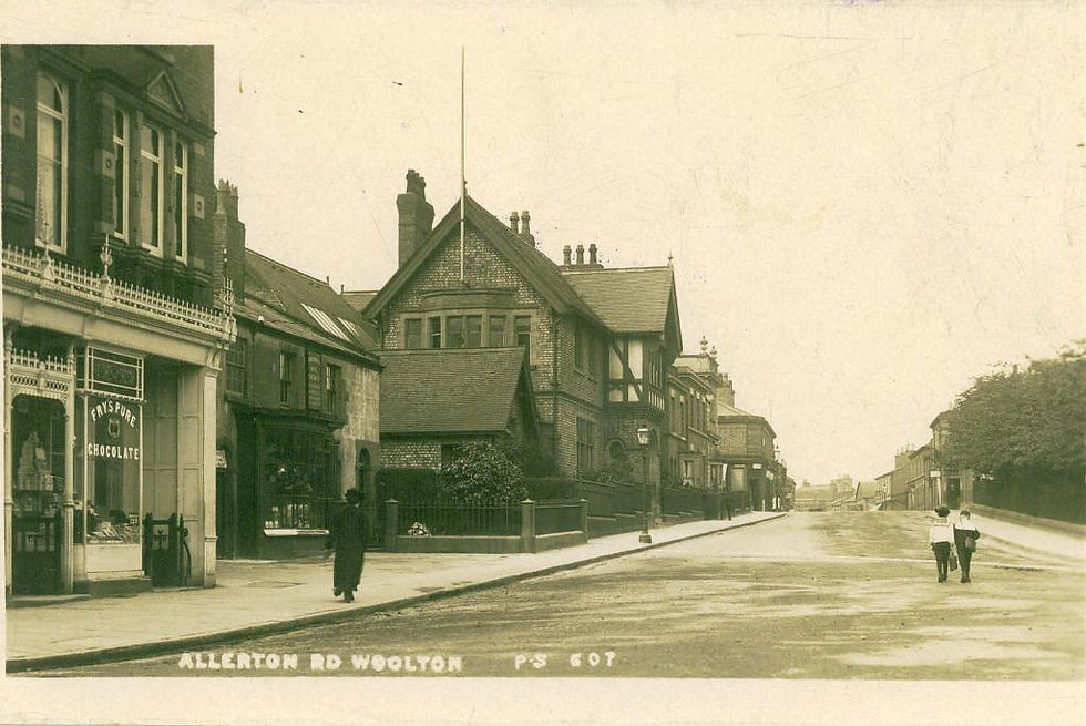
Before we start to review the history of Woolton Hall, we need to turn our attention to a brief history of Woolton and understand the lay of the land, the geology of the area and how Woolton Hall shaped the district from a lonely building to something that is now tucked away amongst the sprawl of the ‘village.’
We must turn our attention to the neighbouring parish of Childwall to review the ecclesiastical side of things. Childwall Parish Church (All Saints) parish had 10 townships under its wing. In short, the parish of Childwall once ran down to Hale Village – and covered all the land in between. There were a total of 10 townships under the Parish of Childwall, these were: Childwall, Hale, Halewood, Halebank, Speke, Garston, Allerton, Much Woolton (with Thingwall), Little Woolton and Wavertree. The neighbouring parishes were divided off as follows: 1828 Holy Trinity Wavertree, Garston, Woolton, Hale. 1856 St. Mary's Wavertree 1876 Allerton 1893 Gateacre (Little Woolton) 1899 St. Bridget's separated from Holy Trinity.
With St Peter’s Church in Woolton not being built until 1886, and before that there was a small chapel near the site of the present church from 1826, Childwall Church was the main Church that parishioners would visit and be associated with. We will come to this later where we find out about the Norris’ from Speke Hall and also the Ashton’s from Woolton Hall. All Saints Childwall holds lots of information associated with Woolton Hall!


Can we return to over 250 million years ago and imagine dry dusty conditions in this area. The winds carrying sand and small pebbles to lay the foundations of Woolton. The great sandstone ridge that carries Woolton on was divided in two sections, each ridge in to two hills, each with measurements of around 300ft and 250ft. The earliest settlement of the prehistoric period were placed on the curve of the 200ft contour facing south-east. The village itself was later built up along the same contour on the south-eastern slope, to project the village from the elements but yet high enough for dry land.
If we look at the earliest noted traditions, we find ourselves being pointed towards the Roman’s being situated on Camp Hill. Investigations into this previously showed detailed evidence of an Iron Age encampment roughly 80ft in diameter with ramparts 10ft high and 15ft wide. Perhaps we can start to look at the history of Woolton with its name. What does ‘Woolton’ actually mean? We need to go back to the Domesday book to see that the name is spelt as ‘Uluentune’ and ‘Wulfa’s tun’ from the Anglo-Saxon personal name ‘Wulfa’ and the Old English ‘tun’ meaning a village or farm.
The translation from the Domesday book are as follows:
Uctred held Uluentune (Little Woolton). There are 2 carucates of land and half a league of wood. It was worth 64 pence.
Ulbert held Wibaldeslei (Lee Park). There are 2 carucates of land. It was worth 64 pence.
Two thanes held Uuetone (Much Woolton) as two manors. There is one carucate of land. It was worth 30 pence.
‘Thanes’ were the Anglo-Saxon names for Knights. Or men holding land by service. We then have to understand that a carucatre had something to do with a parcel of land. If we look at the size of this, it was an area of land that was about 120 acres. Therefore cultivated land in Much Woolton would have been around 8 households with the rest of the land being barren and little use. If we look towards the neighbouring Childwall for valuations of the land, at Childwall there was ‘a priest with half a carucate in alms. Childwall itself was held for four manors and valued at 96 pence. Other local areas such as Wavertree were valued at 64 pence, Allerton being valued at 94 pence, and this would put Much Woolton at the lower end of the scale.
If the value of the land was lower than Childwall, for what reason was this the case? Was Woolton’s barren land not suitable for farming it being situated between two ridges? If we look at Childwall, that too sits high on the hillside and is not an easy climb. We need to look into the history of Woolton further for additional answers.

To understand the lay of the land, we can review a very early map of 1786 to see the location of Woolton Hall. On the map to the left it is marked as the enclosure above the name ‘Nicholas Ashton Esq’, the owner of Woolton Hall at the time.
While we are reviewing the map, it would be a great opportunity to provide some information on the ‘summer house’ that can be seen in the top left-hand corner of the map. How we could go back in time to experience the lay of the land as it was!
In 1769 William Yates and George Perry published their Map of the Environs of Lever pool Drawn from an Actual Survey Taken in the Year 1768.
At the S.S.E. end of an area marked "Childwall Heath" is a point described as "Summer House." Elevated areas are surrounded by shaded lines, and it is within one of these areas that the " Summer House " is shown. There can be no doubt that the " summer house on Chilwell-hill" mentioned by Derrick and the " Summer House " on the Yates and Perry map refer to the same building.
Some years ago the late Robert Gladstone told the writer that he had seen the Woolton Summer House from the top of the Woolton Reservoir. He suggested that the summer house was worthy of closer inspection with a view to ascertaining if the present building was that mentioned by Derrick. It was in response to this suggestion that the following notes on the summer house were compiled.
The summer house stands in the Knolle Park estate, a fine property with frontages on Beaconsfield Road and Church Road, Woolton. It is just within the Little Woolton boundary. “In the autumn of 1938, by kind permission of the Sister-in charge, I visited Knolle Park to inspect the summer house.
The building is a regular octagon and is stuccoed over red sandstone. The soil has receded at the base, leaving the unstuccoed stone exposed. Each of the eight sides is six feet in length, and from the ground to the eaves is ten feet. The walls are about sixteen inches thick.

The low-pitched roof is of slate with ridge tiles ; it is in eight sections corresponding with the walls. Originally there were three windows facing south, south-west, and west. The south-west window has been built up, but the sill remains. The door is in the north-east wall and is approached by two or three steps. The summer house is surrounded by a circular wall, about eighteen inches high, in a rather decayed condition, partly stone and partly brick, surmounted by a stone coping and iron railing. The shrubs which surround the building make it impossible to photograph the lower portion.”
“The interior is plastered. The stone floor is about two feet above the ground level. The ceiling is also plastered and is in eight sections corresponding with the roof. The trees which are now so plentiful near the summit date only from when Childwall and Woolton Heaths were laid out as large residential properties ; but even to-day, notwithstanding the surrounding patches of woodland, the view from the summer house is exceptionally fine.”
Derrick, as mentioned above, states that it extended to fifteen counties. Baines, in his Liverpool, comments : "It would have puzzled Mr. Derrick to have named the fifteen counties visible from Childwall, though few views can be finer than those obtained from that spot, and from the ridge on which Childwall stands, of the plains of Lancashire and Cheshire, the River Mersey and the sea, and the mountains of Flintshire, Denbighshire, and Carnarvon. In very clear weather Black Comb [Cumberland], the Isle of Anglesey, and the faint outline of the hills of Yorkshire, Derbyshire, and perhaps Stafford- shire may be seen, but it would require a strong imagination, as well as good eyes to make out the other counties."
Isaac Greene, the prosperous Prescot attorney, acquired the manors of Childwall, Much Woolton and Little Woolton in July 1718, and the summer house was therefore built at some time between that date and Greene's death in 1749. Greene married in 1725, and rebuilt Childwall Hall as his principal residence before 1728, and we may assume that in all probability the summer house also was then built. It was situated about a mile from the Hall and was doubtless used as the objective of many a delightful walk across the then unspoilt heath.
The summer house is devoid of architectural details which might enable one to fix approximately the period of its construction. There may, however, be buildings in existence of known date so similar in construction as to afford corroborative evidence of date. One such building is the porch of the Friends' Meeting House and School at Lancaster, of which an illustration is given. The City Librarian and Curator of Lancaster (Mr. G. M. Bland) informs me that this porch was built in 1708. The original Meeting House was built in 1677. A new one was erected on the same site in 1708, and although a lintel within the porch has in it a stone dated 1677, a Meeting House minute book records that the porch was included in the rebuilding scheme of 1708. The 1677 stone, probably for sentimental reasons, was evidently incorporated in the 1708 building. No trace now remains of the Woolton summer house. It is marked on a 1900’s OS map behind Knolle Park as a small ‘building’ above the B. M. 277.0


On the left, we see the OS six inch, 1840s-1880s (county layers) map that provides the first real detail on the layout of Woolton Hall compared to its surroundings.
Its nearest ‘neighbour’ would have been the Much Woolton Old School which can be seen at the bottom of the map. This building was built circa 1610 and is nearly 100 years older than Woolton Hall itself.
There is also mention of a ‘Summer House’, but this is not the same summer house as the one described above, but an additional summer house within the (then) private grounds of Woolton Hall. How fantastic would it have been to wander around the private gardens of Woolton Hall – now Woolton Woods!
On the right, we are now focusing our attention on the OS Six Inch 1888-1915 map that provides clearer detail on Woolton Hall. By this time, it has been enlarged and the area around the Hall is slowly being built up.
On the right-hand side of the map, Ashton Square is mostly overlooked in the present day. A small dark lane that you wouldn’t notice in the car, this was built for the workers who tended to Woolton Hall and was named after Nicholas Ashton.
Even over 100 years later, Ashton Square is still on the map and still holds a row of small cottage type houses that form their own little courtyard. They are very small but very pretty houses, merely a ‘two up two down’ arrangement but very well hidden from the surrounding area and unless you walked up the lane, you would not know it was there. If we return to our attention to Woolton Hall, what is the earliest date of the building?

If we are to go on the general consensus that it was built for Richard Molyneux in 1704, then case closed. A new building for Woolton at the start of the 1700’s. But upon delving into further historical papers, the following evidence must be submitted as part of the brief history on Woolton itself.
Depending on which source of information is reviewed, the land at Woolton Hall has been occupied since 1180 when the area of Much Woolton came under the lordship of the holy Catholic order of the Knights Hospitaller, who held this portion of land for over 350 years until the English Reformation took place. Back in the 16th Century, Henry VIII’s dissolution of the monasteries suppressed the Knights Hospitaller leading the land being confiscated but then later restored by Mary I. This land was permanently confiscated from the order in 1559 until Elizabeth I and was kept by the crown until 1609. Hitherto, the land came under ownership of the Brettarghs of Holt who were reputed to have acquired it from an ancient family named ‘de Woolton’.
On the death of William Brettargh in 1609, the land was described as being home to a cottage. It was then noted that between 1700 and 1704, the house and surrounding estate was sold to politician Richard Molyneux, 1st Viscount Molyneux who built the northern block of the Hall.
THE HISTORY OF WOOLTON HALL